


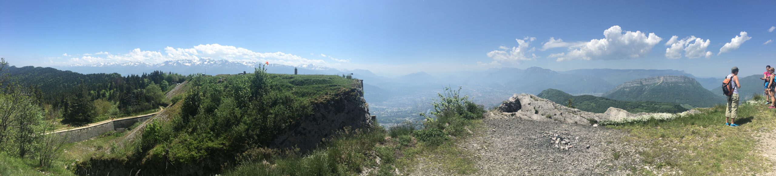
I have finally sat myself down and finished this short travel log of our hike in the Grenoble mountains at the end of May. Silviu was in Grenoble for a one-day conference on Friday, so we extended our stay till Sunday to do a little sightseeing in this southeastern city of France and, more importantly, to explore the surrounding mountains.
Grenoble sits on the alluvial plains of the River Isère and River Drac, at an altitude of 214 m. The city is flat, but mountains surround it. What I find fascinating about the city is that, regardless of where I am in the city, when I look up, I can always catch a glimpse of either the foreboding angular greyish blocks of the Vercors Massif to the south and west, the Chartreuse Mountains to the north, or the snow-capped Belledonne Range to the east.
Unlike the trip to Vosges, which we made at the end of April, we enjoyed splendid weather this time. It rained the following day when we left for Paris, and the week after was one of rain and floods across France.
We had planned a run of 40 km, 2,400 m/D+ in the Chartreuse Mountains, and we achieved our goal. It was an exhausting, quads-destroying 9 hours. It had been close to 6 months since I left Hong Kong, and this was the last time I had done any proper training with elevation, not counting our Vosges trip, which was mainly a resistance-training trip — trudging through piles of snow.
From the centre of the city, our first climb was up to the Bastille, a fortress standing at an altitude of 476 m above sea level. The first part of the climb was on a serpentine gravel path (I counted at least 10 bends), gaining 250 m/D+ in less than 3 km, then a flight of steep, high concrete steps led us to the fort.
At 10am on a Saturday, there were already many runners descending from Bastille, finishing their workout, I assumed, and ready to enjoy the rest of the day at leisure with family and friends. There were also others, like us, who had started later and were now jogging, or fast-hiking, up the serpentine path.
We had initially planned a steady hike up Bastille so as to preserve our energy for the 40 km. However, the tapping sound of the hiking poles kept us on our toes, reminding us not to slow down and risk falling behind them (which would be quite embarrassing). Unfortunately, we could not hold our own as a bespectacled, sinewy-looking gentleman in his sixties zoomed past us. With a deep look of concentration on his face, he propelled his hiking poles alternately forward and backward, creating a fluidity that was a sight to behold. The gentleman then steered his powerful weapons in a direction opposite to ours at the junction just a few metres away, sparing us the need to keep up with him.
After zigzagging across the countless bends of the serpentine path, we reached a steep flight of concrete steps that took us straight to the entrance of the fort. There, we went down another flight of steps into a long tunnel, where a powerful lamp on the roof lit the way. This is the way to the Mandrin Caves, a network of caves the army carved in 1844 into the cliffs of Mont Jalla, in front of the fort, as part of the Bastille’s defense system.
The long tunnel that leads into the Mandrin Caves.
Following are some photos we took on the way:
We were starving by the end of our 9-hour run. Our recovery meal was two upsized McDonald’s meals, which we ate at the hotel, and we topped that up with some recovery drinks at St. André Square.